The sign explains why we purchased extra gas cans in Tonopah. The problem was where to carry them. Jan suggested using a milk crate and strapping them on the roof rack. Next problem was where to find a milk crate. None of the local stores had any for sale but while driving past a convenience store Jan spotted two crates. She walked inside the store worked her magic and came walking back to the truck with a milk crate. Two ratcheting straps secured the load and now we could spend a few days exploring the Toquima Mountains.
We drove through Manhattan, Nevada on the way to Belmont. In 1907 4,000 people lived in Manhattan. Today there are about 120 residents.
Visited the old school house which is now a branch of the county library.
One of the classrooms remains as a museum.
This old wall map must date from the 1930's because Japan had possession of Taiwan.
The country store is closed but the Manhattan Bar/Motel is still open for business.
Next stop Belmont, Nevada. This town was booming in the 1870's with a population of 15,000.
The Nye County Courthouse was built in 1876. The Toyota Tacoma 2002, FWC 2006.
The Combination Mill east of Belmont.
Ruins in Meadow Canyon on the way to Jefferson Pass/Summit.
The old Meadow Canyon Ranger Station.
Taking a closer look at the cabin we noticed a bird nesting in the hole to the left of the door.
Taking a closer look at the cabin we noticed a bird nesting in the hole to the left of the door.

Our camp about 1/2 mile north of Jefferson Pass/Summit. Mount Jefferson in background. The summit of Jefferson was about five horizontal miles and 3,500 vertical feet away. While sitting in my camp chair watching the sunset cast a golden glow on the mountain I decided to visit the next morning.
Survey marker, there were several on the summit.
South and highest summit of Mount Jefferson, 11,941 feet.
Looking south toward our camp.
During the approach I rode my bike north for about about a mile along a road that follows the ridge line. It made the return to camp much faster.
Second dawn at Jefferson Pass/Summit camp with Shoshone Mountain to the south.
Surprising amount of water in the Monitor Valley.

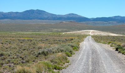
The road to Diana's Punch Bowl.

The azure 200ºF waters of Diana's Punch Bowl. Jan and I visited this spot ten years earlier. It still looks the same but we have more wrinkles.
Jan gazes into the depths of this remote geothermal feature.
Opening and closing fence gates is the passenger's job. At this gate Jan found it easier to close the gate than she expected. Then she realized that she was on the wrong side of the fence. A great deal of laughter was heard near Diana's Punch Bowl as a result of this maneuver.


Revisiting your post here. We watched you starting for the Mount Jefferson summit as we were relaxing on top. We thought your campsite, far below, looked so good that we spent the next night there in our FWC.
ReplyDeleteWe spent two nights at Jefferson Pass. Sorry we missed you. The Nevada mountain ranges above 8,000 feet in the summer are special. Cheers.
Deleteive been reading both of your blogs
ReplyDelete