We drove north to Bishop and then NE toward Montgomery Pass. Our shadow looks more like an SUV rather than a FWC.
As we passed through Benton, Jan remembered that she used the facilities at this establishment in July. We didn't stop and see if a plaque had been placed to mark that event.
About 20 minutes later the sky behind us erupted in orange and yellow.
Dawn at our Montgomery Pass Camp.
We drove on to Rhodes, Nevada. Before the completion of the Carson and Colorado Railroad salt was transported from here to Virginia City using camels.
The only structure still standing in Rhodes.
We climbed to the top of a prominence named Rocky Hill to survey the surrounding desert. The White Mountains are far in the distance with Montgomery Peak on the right.
We decided to drive east into the Monte Cristo Mountains and visit the Devil's Gate.
Around 1 PM I suggested to Jan that we stop and prepare some hot dogs for lunch. She told me that just minutes before the same idea had crossed her mind.
The Devil's Gate appears less ominous than the name implied. There are 18 features using the word devil in Nevada. 98 in California. Draw your own conclusions.
Exiting the Monte Cristo Range.
McKinney Tanks east of Tonopah. Some report that it was a stage line station.
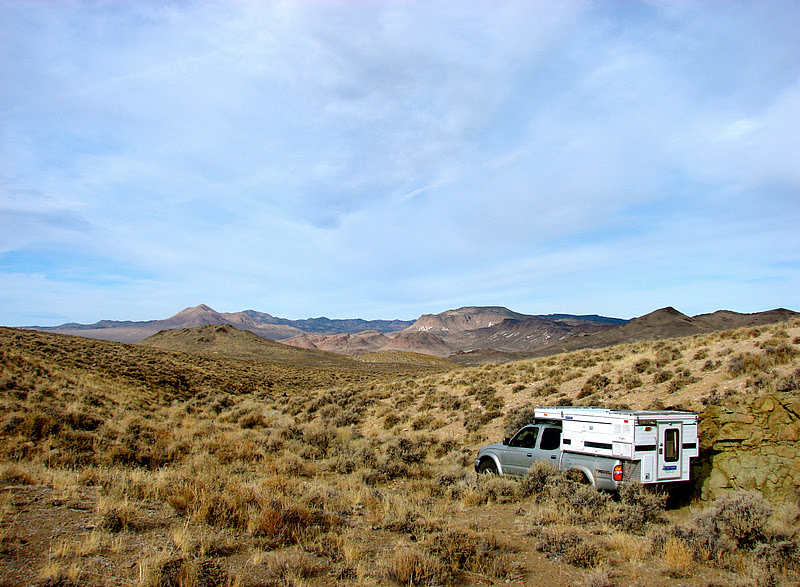
Driving south of Yellow Cone looking for a campsite.
Our camp at the southern end of the Monitor Range looking south into Nellis Air Force Range now known as the Nevada Test and Training Range(NTTR). Groom Lake (Area 51) is SE.
Dawn at our second camp. The spot we found had been dozered flat around 40 years ago as evidenced by the 55 gallon drum containing some charred pulltab cans. "By June 1963, 40 brands were using pull tabs. By 1965 three quarters of the breweries in the U.S. were using them. The designs kept changing, however, in response to customer complaints and comments. Ten years after the "ring" version of the pull tab was introduced, an answer to this environmental and safety nightmare finally came when the "stay-on-tab" style was introduced. " From
Squidoo.com.
When ever we find something abandoned alongside an old road it makes us curious about its story.
Remains of a cabin SW of our camp.
Jan spotted this shovel strategically placed in a rock outcrop along the road. Did someone leave it to mark a spot or forget it after digging out a stuck vehicle?
Driving back to US 6 on an old road and seldom traveled road. Jan's shovel find is about 50 feet behind the truck.
Driving up Kiln Canyon in the Hot Creek Range.
Approaching our destination. If the reader chooses to visit these charcoal kilns prepare for a slalom like drive between the trees.
These kilns were probably built in the 1870's to support the smelter in nearby Tybo.
A lost treasure may still be hidden near the kilns.
Inside looking up. There are three more kilns about 1.5 miles to the south but we did not visit.
Exiting Kiln Canyon. We decide to cross Hot Springs Valley and drive through McCann Canyon on our route back to Tonopah.
A frozen marsh near the ruins of McCann Station.
"Grace McClosky was born in Ireland in 1838 and came to America in 1855. She arrived in Nevada first living in Virginia City for a short time and then in 1866 moving to Belmont following the mineral strike. While there she married Bernard McCann and had five children. The family relocated to Tybo where two more children were born. Bernard died there in 1879. Grace ran a boarding house for some time in Tybo after her husband past away. Later Grace went over the summit to purchase a Stage Station between Tybo and Belmont where she would run a toll road for several years." - by
Robert Wynn
I found this Smirnoff Ice bottle after photographing the ice covered marsh. An odd coincidence in McCann Canyon.
Another frozen marsh in McCann Canyon.
Off in the distance we spot a large grouping of hoodoo's on the western side of McCann Canyon.
December 31, 2011. We arrived at the historic
Mizpah Hotel, built in 1907. An excellent location to usher in 2012. Our stay at the Mizpah was a wonderful experience. The room was comfortable with a flat screen television, wifi and more than a hint of history. We heartily recommend that anyone passing through Tonopah spend the night at this elegant hostelry. If any additional encouragement is required; dining at either of the hotel's two restaurants is also a wonderful experience.


