Late on Saturday night we drove north toward Death Valley National Park. The bright lights, rising steam and aroma of sulfur from the Searles Valley Minerals soda ash processing plant announced that we were nearing the small desert town of Trona.
Every four or five years the only gasoline station in town has a new name and location. Several decades ago there were at least three stations in Trona.
Trona High School has the only dirt football field in the United States. After leaving the lights of the sleeping town behind we crossed over the Slate Range and drove north through the Panamint Valley to Lake Hill Road.
Driving north on the Lake Hill Road I spotted an odd object on the road ahead.
How in the heck did a rectangular piece of snow come to be resting in the middle of a desert road. Two minutes later the answer appeared in the darkness. An SUV was parked alongside the road with load of snow on the front of its roof.
It was about an hour after midnight when we drove past the trailhead for the dunes, continued 300 yards up the Big Four Mine road and set up camp on the only level spot we could find.
Dawn at the northern end of Panamint Valley.
About 1/2 mile below us Austin and his friends had set up camp the evening before. Shortly before midnight a desperate looking man walked into their camp asking if he could have something to drink and warm himself at the campfire. He soon revealed that he was lost and had been wandering around the valley floor for hours looking for his car until seeing the light of their campfire. This lost soul wasn't wearing a jacket and had no water. Later he was reunited with his vehicle back at the dunes trailhead.
The Panamint Dunes from our camp.
For several decades I had planned to visit the Big Four Mine. The mine was once owned by Agnes Reid who with her husband built the Panamint Springs Resort. -
The Old Trailmaster After hiking about a mile the road disappeared at a wilderness sign, placed there after the passage of the Desert Protection Act in 1994. Looking beyond the wilderness sign the road looks impassable but looks can be deceiving.
The road 100 yards past the wilderness sign looks very drivable.
Just as passable as the road to the sign.
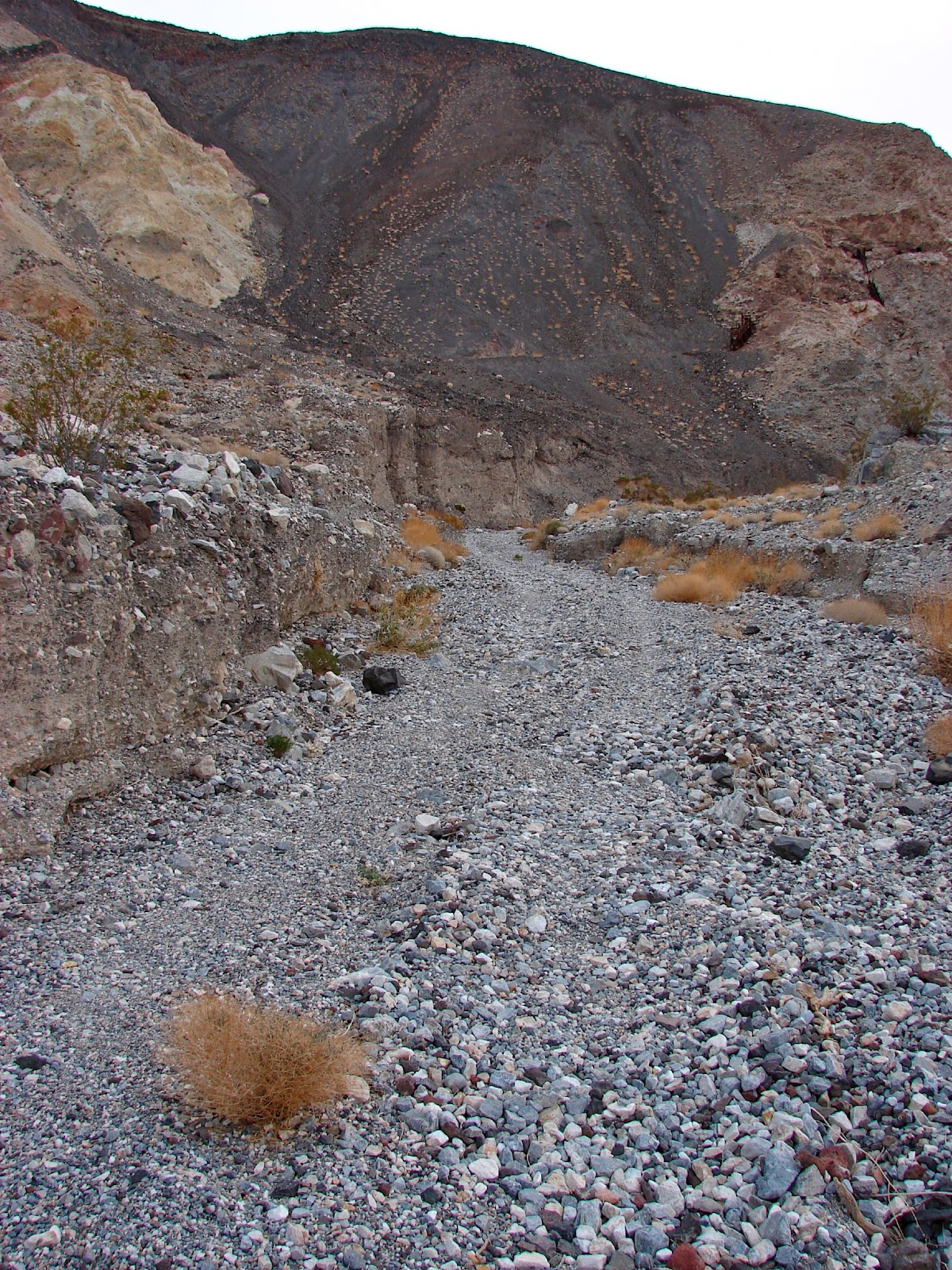
Frames, adits and rails of the Big Four Mine were sighted high on the canyon walls.
"The last new metallic ore discovery in Inyo County, like the first, was silver. The Big Four Mine (known also as the War Eagle) is a lead-silver-zinc mine located seven miles northeast of Panamint Springs. Although possibly first discovered in 1907, it was never more than a prospect until William Reid restaked three claims in 1940. Development work began in 1942 and 370 tons of ore was extracted between 1944 and 1945. Leased from 1946 through 1949 by various persons, the ore averaged 16.6 percent lead, 12.5 percent zinc and 2.6 ounces of silver per ton. In 1952, production amounted to 136 tons of ore." - DESERT FEVER:An Overview of Mining in the California Desert Conservation Area, 1980
Photo Credit: Austin
Austin climbed up to the entrance of the main portal and photographed ore cart rails with the Panamint Dunes far in the distance. Very cool photo.
"The workings are on two levels. The lower levels is a short adit driven S. 20 degrees E., ending in a small irregular slope. The upper level has a 110-foot adit driven along a fault S. 55 degrees E. The adit ends in an irregular 80-foot stoped section. Recently, an adit was driven eastward from the portal of the lower adit; stoping will continue from this new heading.
A 900-foot crosscut adit was driven N. 70 degrees E. at the base of the hill many years ago. To the northwest across the canyon, two 30-foot adits have been driven N 25 degrees E. and N 30 degrees E. in 1947. Thirty tons of shipping-grade ore was produced.
The present location of the property was made by William Reid in 1940 and the first work was done in 1942. In 1944 and 1945, and 372 tons of ore was mined. In 1946 11 cars of ore were shipped. In May 1949 some work was done by two men on contract basis." - California Journal of Mines and Geology, Vol. 47, No. 1, Jan. 1957 - Wikimapia
Not much remains of the camp except for a few foundations, some timbers, cables and this stove.
An artistic previous visitor created this artifact art.
I continued up the canyon beyond the mine until hiking started to become scrambling. Spotted this view of dunes while hiking back down the canyon.
Lake Hill and the Argus Range from the mouth of the Big Four Canyon.
Austin's group leaving the valley.
One of three helicopters that flew east over the dunes in the late afternoon.
Snow flurries breaking over Hunter Mountain above the dunes.
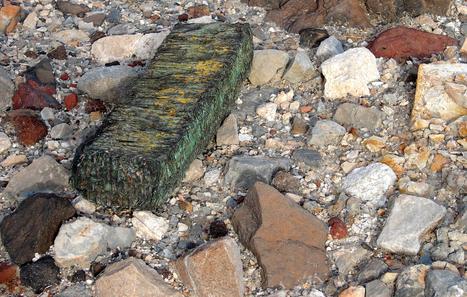
While sitting in a camp chair reading "Missing in the Minarets" I noticed an odd green rock off to the right. The odd rock was a corroding radiator core.
Sunset at our camp below Panamint Butte.
Reflection of crazy hair silhouetted by morning sun. Photo credit: Grungy Camper
After breakfast we packed up, dropped the pop-up and began our drive back to pavement.
Lake Hill and during very wet years the hill is actually in a lake.
A steam bed full of sun warped clay. There must be a deposit somewhere up in the hills.
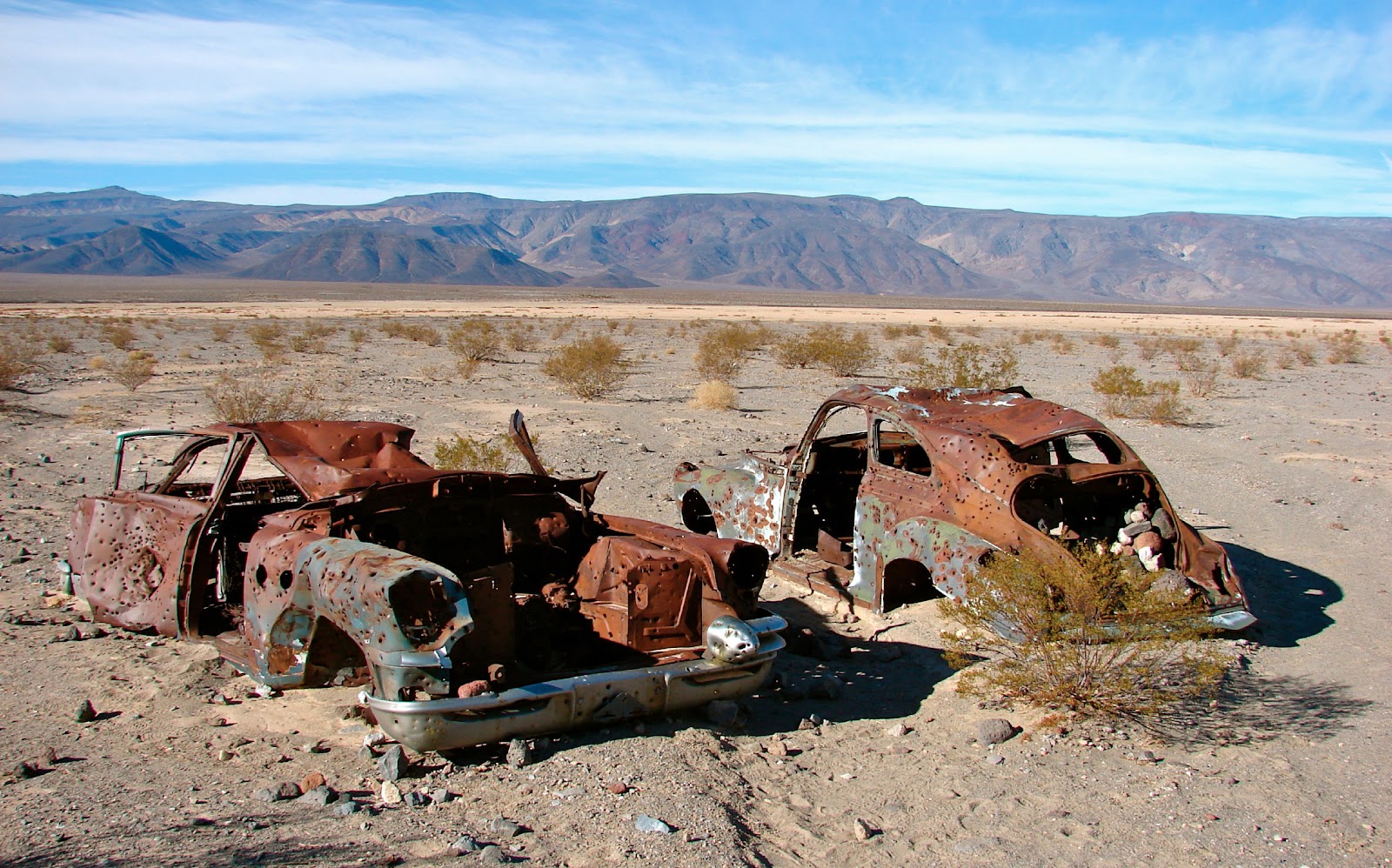
Sometimes I think that this is a much better fate for an old vehicle than sitting in a junk yard, These cars have probably been photographed 1,000's of times. This was the second time for me.
One last view through the windshield.
Looking back. Lake Hill on the left. Panamint Butte on the right.
This sign has always been my reference for finding Lake Hill Road. Telescope Peak in the distance. (Visited its summit in 1998.)
We drove east over Towne Pass on our way to Tonopah to celebrate New Years at the Mizpah Hotel.