Use the archive on the right to view older posts.

Friday, July 26, 2013

Hot Creek and Convict Lake - "flash of lightning and booming crash of thunder"

 After leaving Carson City we headed south for home. We drove the June Lake Loop looking for some friends who camp there every year during this week of July but could not locate their RV. 
Hey Fairchilds, where were you guys?
Next stop was the Crystal Crags Lodge near Mammoth Lakes to meet other friends. When we arrived they surprised us with a pontoon boat picnic. It was a lovely afternoon on Lake Mary, eating, drinking, talking and fishing. All that changed at the first flash of lightning and booming crash of thunder. Lake Mary was quickly cleared of watercraft much to the disappointment of Gena. She had rented a paddle board with the devious plan of photographing me creating a memorable splash. I have no photos of our time at the lake because I didn't take my camera.
 The first time I camped at this location was around 30 years ago with some rowdy friends who enjoyed soaking and other recreational diversions.
If those rocks could talk. This time it was just Jan and I, and the rowdiest event during our stay was a nearby cow calling for its calf just after sunset.
 Jan had never been to Hot Creek, so we drove over to give it a visit. Thinking about 'if places could talk.' From everything I have heard, some lively stories would be told about the antics of people who visited this place, especially in the 60's and 70's.
 The view east. Rats! The plan had been that the next time we came here it would be with a still frame from John Wayne's "True Grit," so I could take a photo at the spot where Rooster and Mattie were waiting for Ned Pepper to arrive at the cabin. Didn't have the photo. Arrrrg.
Looking west. If a reader doesn't have the time to drive to Colorado in search of "True Grit" locations watch this video by JeepsterGal. If you go to Colorado, this website provides directions to the film's many locations. It would have made things much easier for us in 2004.
 After our stop at the hot springs we moved on to Convict Lake for a quick paddle. The wind was much calmer than our visit earlier in the month.
 The smoke from the Aspen Fire, which seemed to be everywhere on the Eastside, was absent.
On US 395 headed south, smoke from the Aspen Fire in the distance.
Time for us to skedaddle home because grandchildren were stopping for a visit on their way back from Japan. Yippee!! We had been on the road for 24 days, 20 in the Four Wheel Camper.

Monday, July 22, 2013

Burnside Lake - "echoing off the rocks above our camp"

We drove back to Blue Lakes Road to visit with some friends who were section hiking the PCT.
 Jan and Jo Ann shared thrift shop stories and discussed the effectiveness of anise as a mosquito repellent.
Later in the evening we heard a vehicle moving fast along the road with a siren blaring. Soon a parade of emergency vehicles passed by our camp. Someone had been injured and when the helicopter flew over our camp we surmised that someone had been critically injured. We never discovered what had happened.
After dinner everyone retired to their respective truck campers for the night.
Shortly before 9PM my game camera photographed Jan. Why is her nose elevated in such an aloof manner?
The next morning we bade farewell to Clark and Jo Ann as they headed south on the PCT. They were backpacking the section from the Tamarack Trailhead to Sonora Pass.
We drove NE on CA 88 and then south on the bumpy dirt road that leads to Burnside Lake.
In the early evening we paddled around the lake exploring the entire shoreline.
 Burnside Lake isn't very large but it is a relaxing place to paddle.
View of our launch site.
We left Burnside Lake around 10AM after an interesting night. Shortly before sunset a small group of young people set up camp about 100 yards from our camper. They then started playing really loud music. Their tunes were echoing off the rocks above our camp. Jan and I looked at each other and laughed. This group of twenty-somethings were playing the greatest hits of the 70's. How could we be annoyed? These were the very same songs we once blasted from our speakers 40 years ago.
Our next stop was Indian Creek Reservoir.
We paddled the reservoir for a short time but found the lower elevation of this lake and its campground a bit too hot and humid and decided to head for Carson City.

Saturday, July 20, 2013

Highland Lakes - "never underestimate the power of beer"

The last light of the day highlighted Hiram Peak as we arrived at West Highland Lake.
 We set up camp in one of the sites that was in the open.
Dawn and the second camp where I would dismount the 80 watt panel and chase the sun.
 The first day we paddled the lake or relaxed in camp reading.
My eyes continued to look up at Hiram Peak and by evening I knew that the next day my feet were taking me to the summit.
 The next morning I grabbed my backpack and headed for the peak. View of our camp from the first ridge.
The hike up was a pleasant jaunt except for two minor inconveniences. 1) the gravel scramble up the eastern slope from the tarns at 9,000 feet. 2) false summit, the highpoint seen from camp was not the summit. The photo above shows the true summit.
 The summit of Hiram Peak and surprisingly, the spire is an act of nature.
I sat down and read the register and discovered that 29 people had summited in the last 12 months. Fewer than I had expected considering how close the summit was to a popular campground. Reminded me of something I discovered in Colorado. You are seldom alone on the summit of a 14'er, but can find endless solitude on 13'ers.
Climbing down the ramp from the summit I decided to descend off the western side. My curiosity had been awakened by a post in the register by a couple who had looped their hike of the peak.

The west side of Hiram did not have a trail but I did occasionally pick up the faded tracks of two hikers. Spicer Meadow Reservoir in the distance.
 At the western end of Highland Lake a group of five 20-something guys were unpacking their car while Jan and I were taking a sunset paddle. We watched as the young men set up camp on a steep hillside above the lake. Then we had a chuckle when they hauled a large cooler up to their camp. One should never underestimate the power of beer.
Dawn and after spending two relaxing days at Highland Lake it was time for us to move on.

Monday, July 15, 2013

Woods Lake - "I'm blaming it on the salsa"

 Woods Lake Camp. This was the first site where I needed to dismount the 80 watt panel and follow the sun.
 During one of our paddles we met Fran Pritchard, the owner of Killer Salsa, in Minden, NV. Back on shore she gave us a jar of her salsa and later Jan reviewed it as "zesty and tasty, definitely not your run of the mill salsa."
 There is a beaver lodge at the far end of the lake but we saw this beaver close to a small island near the parking lot. Jan just about jumped out of the canoe when the beaver gave the water a warning slap with its tail.
This large heron feeding along the shore wasn't disturbed by us or the people fishing along the shore.
For some reason I did not take many photos at Woods Lake.
I'm blaming it on the salsa. (wink)

Sunday, July 14, 2013

Lower Sunset, Tamarack and Lost Lakes - "an encounter with a naked man"

 Our camp next to Lower Sunset Lake. The mosquitoes were intense around sundown.
 We paddled to the opposite side of the lake and explored the shoreline.
 Both of us admired the gnarly nature of this old tree.
 But I was curious about the story behind this burned section and the cable marks.
 Dawn at Lower Sunset Lake with Jeff Davis Peak rising in the distance. I haven't climbed this Jeff Davis Peak but did summit the one in Great Basin National Park, Nevada’s third-highest mountain.
 It was so quiet at Sunset Lake that one could hear the geese landing on the water in a splashing touchdown.
 The sound of the geese landing in the early morning, disturbing her sleep, so enraged Jan that she grabbed a shotgun, paddled into the lake and shot one of the birds out of the sky. Okay, just kidding, that caption was written to check if Jan was really proofreading our blog.
 After investigating several other lakes in the area we drove on to Tamarack Lake.
 The other lakes were low but the water at Tamarack Lake was still high. Just before dinner Jan walked a trail down to the dam. She returned sooner than I expected. Her walk was cut short by an encounter with a naked man hiking. Jan did not invite the naked hiker to join us for dinner.
 Early the next morning the eastern face of Jeff Davis Peak was bathed by the early light of a rising sun. Looking at California's Jeff Davis Peak caused me to reflect on my descent from Nevada's JDP. 'Back in 2004, on our way home after spending three weeks bagging twenty-eight 12, 13 and 14'ers in Colorado, Jan and I hiked to the summit of Wheeler Peak. I decided to cross the col over to JDP's summit while Jan returned down the trail to camp. The traverse to JDP was an easy scramble but the descent off the peak is seared into my memory. A tremendous thunderstorm had formed over the two peaks during my traverse to JDP. About 10 minutes after I left the summit lightning began to crack overhead and the clouds released a torrent of rain. Twenty minutes later hail began to fall. The hail grew in size with each passing minute. Just when it appeared that I was going to be beaten to death by this unusually large frozen precipitation, it eased off. My relief about this change in the weather didn't last long as lightning began to strike the mountain. In a short period of time I witnessed three strikes on the mountainside. One that struck less than a football field away really got my attention. The sound of the thunder was deafening but the sharp sizzling crack of the lightning made my skin crawl.  I am not ashamed to admit that I prayed my way off of Jeff Davis Peak and was relieved to reach the treeline. Once below the treeline gigantic soft flakes of snow began to fall. When I met Jan, with our truck, at the Bristlecone/Glacier Trailhead she calmly asked if I had noticed the lovely and peaceful winter wonderland that surrounded us. A second later I heard a muffled boom of thunder behind me. "Yes", I said, "peaceful, very peaceful." Two hours later we were 5,000 feet lower, in the summer heat and headed for home.' 
Back to dawn at Tamarack: Sometimes the water in a lake is flat with barely a ripple but this morning the water truly was like glass.
 The air was a dead calm and there wasn't a ripple on the surface. Jan said, "The lake was like a mirror."
 Just the right amount of clouds in the sky.
 Later in the morning we met a federal water master who was on his way to open a valve and send the waters of Tamarack Lake down stream.
 We paddled this lovely lake several times during our stay.
 These geese followed me as I walked down to the dam. Had other people fed them and were they looking for a handout?
 Leaving Tamarack Lake.
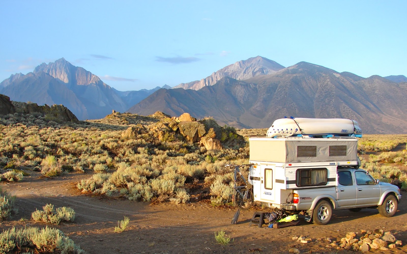
 We moved on to Blue Lakes but found the campgrounds crowded so we drove up the dirt road to Lost Lakes. My forest service topo map showed this road as the old Blue Lakes Road. Camper top only partially popped up to achieve better irradiance from the late afternoon sun.
 This 'lost lake' seems to have misplaced some H2O.
 When researching our trip the photos I found of this lake were spectacular.
 Next time we will visit before the lake is drained.
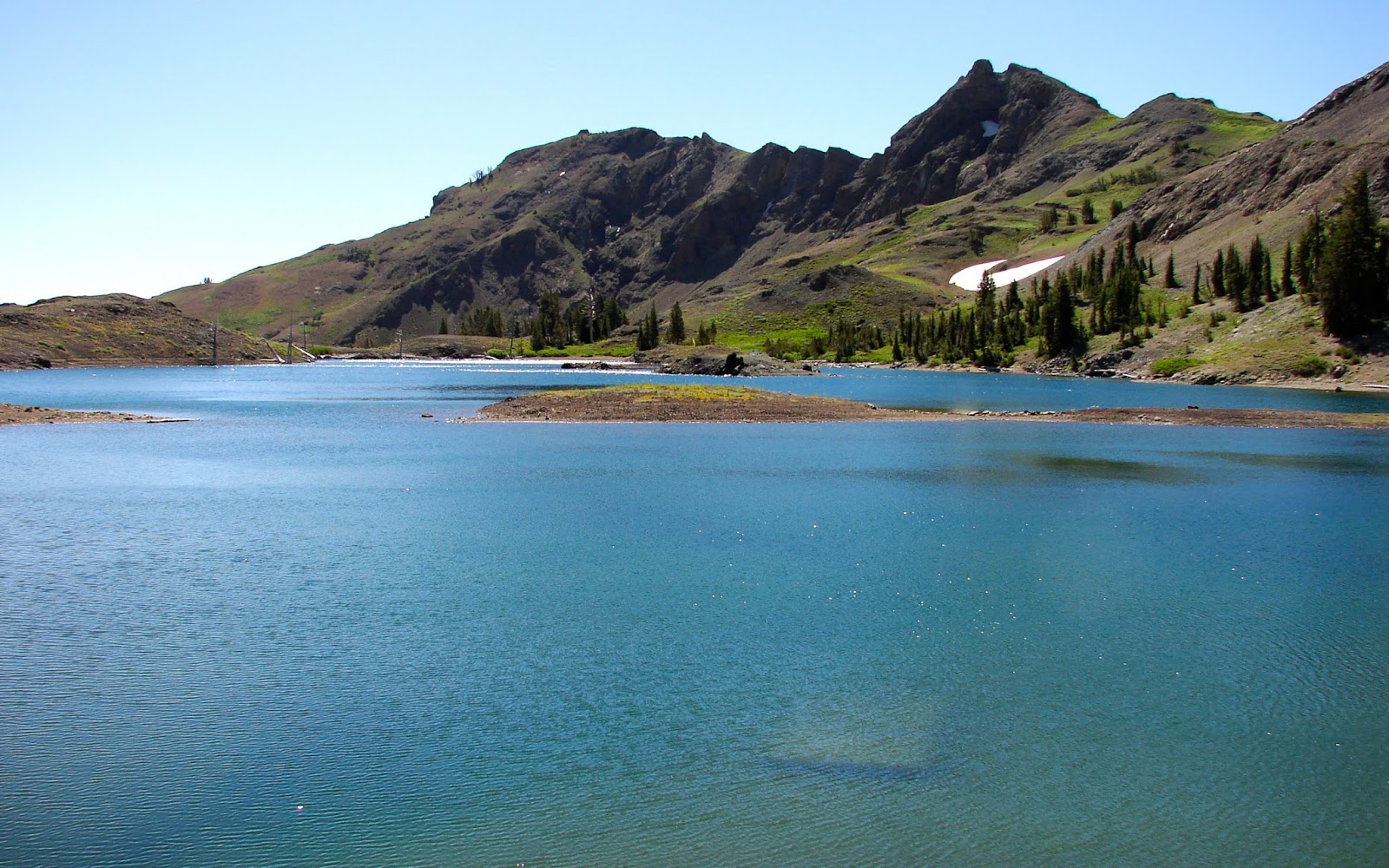
 I hiked up to the higher of the two Lost Lakes and found that it held more water than its neighbor.
 Hiking past this stump on the way back to camp I remembered something that my grandfather taught me back in the early 60's. Whenever we were at a lake where the water was low he would encourage me to look for lost lures.
 Found this one hanging on the second stump I checked.
 Upon leaving Lost Lakes we drove higher on the dirt road eventually crossing Forestdale Divide.
 On the divide we met two guys who came up to ski the last of the snow.
Descending the Forestdale Divide Road and headed for pavement.