Use the archive on the right to view older posts.

Thursday, June 30, 2016

Kaibab Plateau, North Rim Grand Canyon Pt. 2 - "rain hammered the camper"

After leaving Marble Point we drove on through the forest toward Saddle Mountain.
When we reached the Saddle Mountain trailhead our route continued on to a promontory about a mile to the East.
Looks like Sarah was here again.
Our camp on the promontory.
Rain over the canyon.
About 90 minutes later a large storm cell began to head our way.
The lightning and thunder moved closer.
We abandoned our campsite and retreated back into the forest.
And just managed to set up the camper before the clouds released a downpour. For about three hours the rain hammered the camper, flashes of lightning lit the forest and thunder boomed across the plateau.
The next morning we drove back to the Saddle Mountain trailhead and re-established our camp.
Another view of the Canyon from our North Rim camp.
Later in the morning Bosco and I hiked the Saddle Mountain Trail.
It was hot and humid and shade was scarce.
Discovered a summit register on Peak 8881.
We hiked on toward a forested flat about two miles in on the trail.
View Southeast toward Seiber Point.
On the way back to camp another storm formed over the canyon and started to head in our direction.
I hustled down the trail with Bosco moving a lot faster than me.
About an hour after Bosco and I returned the storm hit and we spent most of the evening in the camper.
The next morning shortly after breaking camp we sighted this couple.
Then it was on to the next part of our North Rim trek.

Wednesday, June 29, 2016

Kaibab Plateau, North Rim Grand Canyon - "the blazing hot desert"

 Our camp in the Kaibab National Forest north of Grand Canyon National Park. We arrived here around 2AM after driving across the Mojave at night because of the blazing hot desert daytime temperature. At 11PM when we drove through Las Vegas the temperature was 96ยบ.
 In the morning we enjoyed cloudy skies and a cool breeze.
 It was wonderful to be in cooler weather but soon it was time to pack up camp and drive on to our original destination.
 Our route was along a very straight road that paralleled the park border.
 For miles the road traveled in a straight line with the boundary about 100 feet to the south.
 Eventually we turned North on another equally straight road.
 And then a right turn through the forest to reach our destination.
We set up camp at the edge of the forest.
 Looking Southeast toward the canyon.
 Bosco and I hiked out to the point.
 We stumbled across this survey marker on our stroll.
Marble Canyon from Marble Point.
 As Bosco and I returned to camp rain clouds were forming.
 Soon they were headed our way. About ten minutes after this photo hail and rain pummeled our camp.
 After the storm a rainbow appeared over the canyon. The remainder of the afternoon and evening was calm and cool.
Early morning on the North Rim.
 After a leisurely breakfast it was time to move on to another campsite.
We made a quick stop to hike down into Marble Sinkhole.
This ancient sinkhole was about 40 feet deeper than the surrounding terrain and showed evidence of development.

We drove on through the forest.

Wednesday, June 22, 2016

Papoose Flat, INF - "it became steeper and rockier"

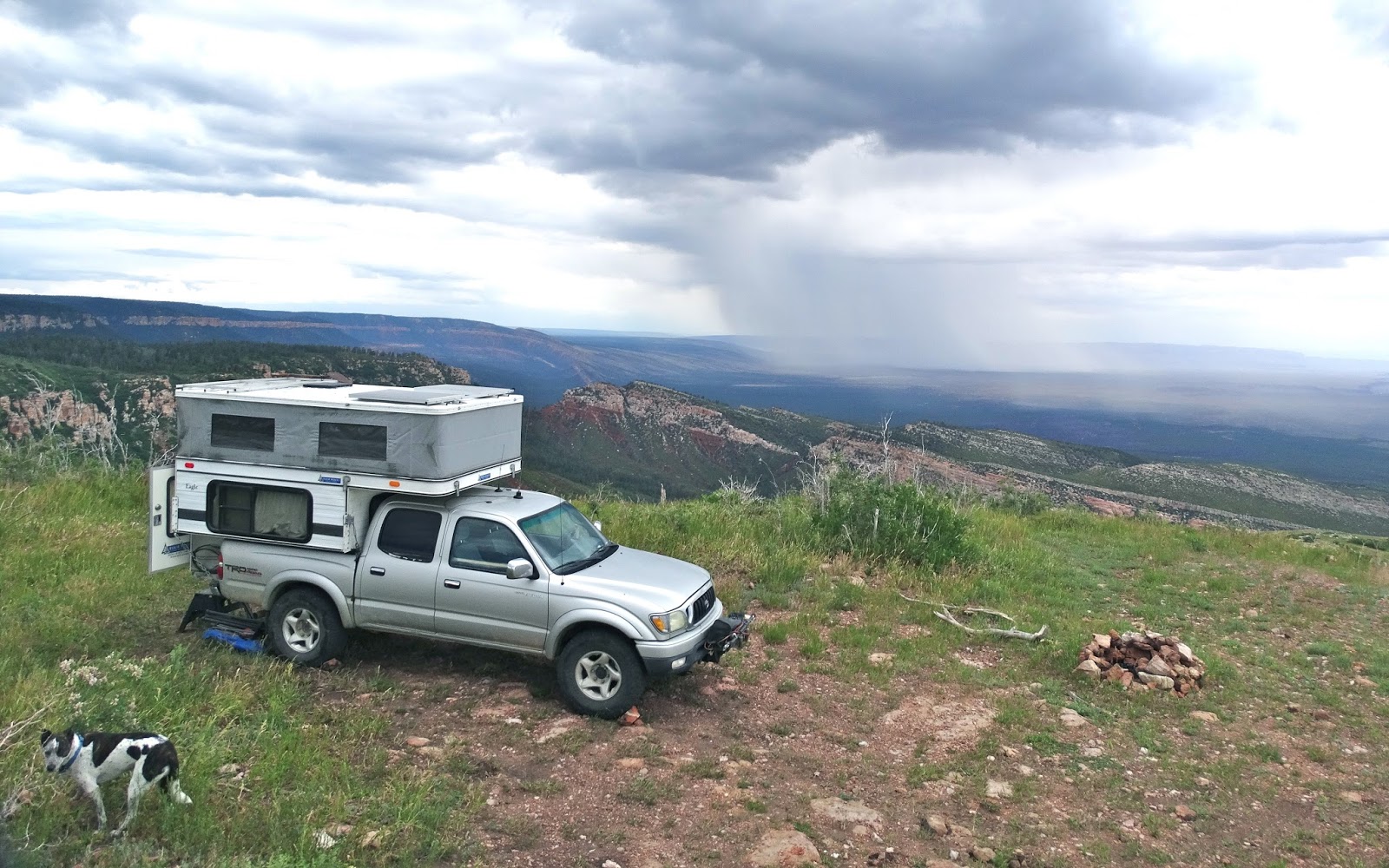
Papoose Flat was our destination because Jan had never been there and she wanted to see it. The fact that the flat was over 8,000 feet was a plus because we were looking for cooler temperatures.
Devil's Gate.
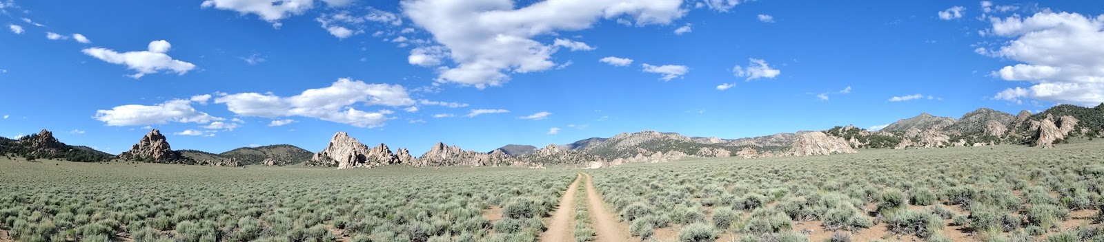
The road to Papoose Flat began here.
One of the many cacti in bloom.
As the road climbed up the ridgeline it became steeper and rockier.
When we passed through this narrow gate the rocky sections diminished but the road became steeper.
After a couple of tight switchbacks we gained the top of the ridge.
In a few more miles Jan had her first view of Papoose Flat.
We drove East looking for a campsite I had discovered on a previous visit.
Soon we located the arch that marked the location of our campsite.
Jan and Bosco scrambled up to the portal for a photo. 
As the shadows grew long we set up camp on Papoose Flat.
On a visit 15 years ago I had remarked to a friend that this would be a nice place to climb. So after dinner I decided to look for evidence of such activity. It only took a couple of minutes to spot a hanger.
Sunset through the portal.
15 second exposure with three seconds of light paint of the foreground.
As the sun rose in the East the moon set in the West.
After breakfast I flew the drone around the top of the arch formation to look for more bolts and anchors. The air around the rock warming with the sun was turbulent.
Bosco can't figure out if the quadcopter is friend or foe.
Scattered clouds formed over the flat.
Later in the day Bosco and I hiked away from camp to circle around some of the "erosional remnants of the Papoose Pluton that now stand as spires and monadnocks." - Esoteric jargon courtesy of AG Sylvester, UC-Santa Barbara.
As the afternoon ended we circled around one of the larger monadnocks and started back to camp.
Obligatory photo of vehicle through arch.
Bosco relaxed beside me
until he heard Jan open a package inside the camper.
The moon rose over a ridge to the East signaling the arrival of evening.
Sunset highlighted clouds in the Wave of the Sierra Nevada.
15 second exposure of Papoose Flat in the moonlight.
Dawn and a few hours later we packed up camp and drove south.
We decided to take the 4x4 road south to Badger Flat and Mazourka Canyon.
The road south out of Papoose Flat climbed the ridge ahead.
The only difficult portion of the road was a rocky 100 yard climb.
The traction was good as we drove up the ridge. It was just a matter of finding the right line.
We motored across an unnamed valley.
And then up and over another ridge.
Many wildflowers were still in bloom along the road.
The end of the 4x4 road at Badger Flat.
We drove across Badger Flat and set up camp on the southern shoulder of Mazourka Peak.
Dawn.
Our route down Mazourka Canyon.